Titre
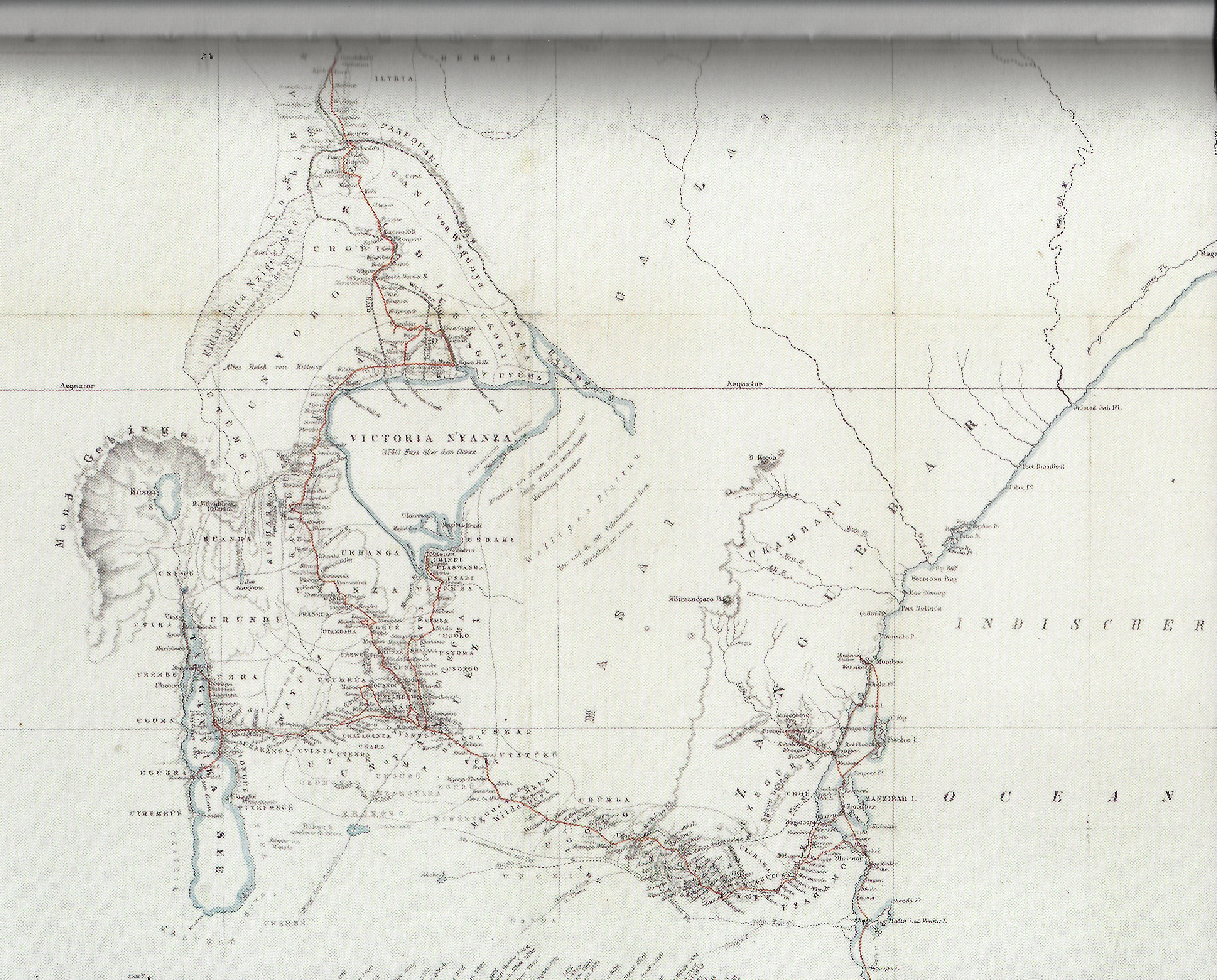
Karte des östlichen aequatorialen Afrika gezeichnet von Keith Johnston
Sous titre
Le tracé rouge permet de suivre l'itinéraire du voyage de J. H. Speke en 1858
Extrait de
John Hanning Speke, Die Entdeckung der Nilquellen : Reisetagebuch, Leipzig : Brockhaus, 1864
Commentaire
We recognize on the left the « Mond Gebirge » which border a lake named Rusizi to the north. It's Lake Kivu. According to this German map, the Moon mountains are Virunga volcanoes north of the city of Goma.
Type
Carte géographique, photo aérienne ou satellite
Haut
fgtquery v.1.9, 9 février 2024